FROM MINERALs EXPLORATION TO EXTRACTION

Geological Services
Our company provides specialized geological services for mineral exploration, aimed at identifying and evaluating economically viable mineral deposits. Through detailed geological mapping, lithological and structural analysis, and systematic rock and soil sampling, we help define the geological setting and mineralization patterns of target areas. Our fieldwork is supported by modern tools and data interpretation techniques, ensuring accurate resource assessments and guiding effective exploration strategies.
Geological Services for Mineral Exploration
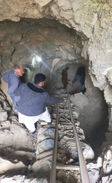
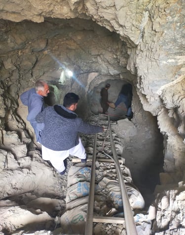
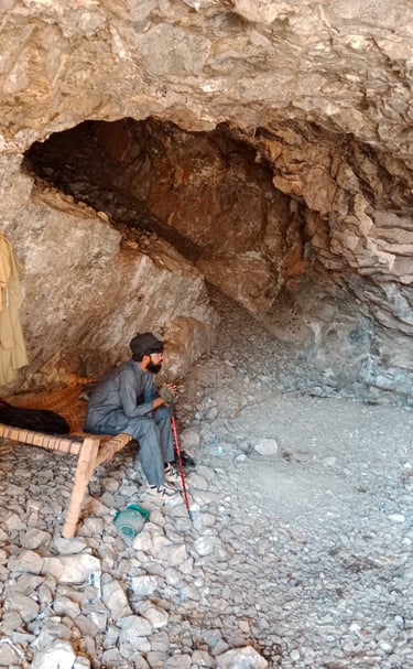
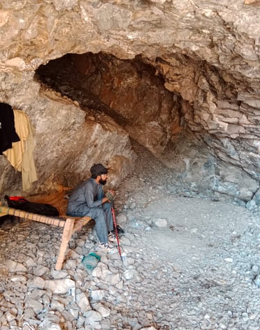
1. Field Study
Description: A fundamental component of geological studies, field studies involve the direct observation and collection of geological data in a specific area.
Key Activities:
Mapping: Recording rock types, structures, and mineral occurrences.
Sampling: Collecting soil, rock, and sediment samples for laboratory analysis.
Observation: Noting geological features such as faults, folds, and mineralization.
Purpose: Provides the foundational data for further analysis, allowing geologists to understand the geological history and processes of the study area.
2. Structural Modeling (2D and 3D)
2D Structural Modeling
Description: Represents geological features and relationships in two dimensions, typically through cross-sectional diagrams.
Applications: Used for visualizing the arrangement of rock layers, faults, and folds to understand geological structure.
Techniques: Creation of geological cross-sections based on field data and drilling results.
3D Structural Modeling
Description: Provides a three-dimensional visualization of geological structures, offering a more comprehensive view of subsurface conditions.
Applications: Useful for resource exploration, understanding geological formations, and planning mining operations.
Techniques: Utilizes specialized software to integrate data from boreholes, geophysical surveys, and geochemical analyses to create detailed 3D models of the geological setting.
3. Stratigraphic Study
Description: Involves the analysis of rock layers (strata) to understand their composition, distribution, and age relationships.
Key Activities:
Layer Identification: Mapping and describing distinct layers of rock.
Correlation: Establishing relationships between layers across different locations to understand geological history and processes.
Chronostratigraphy: Dating the layers to construct a timeline of geological events.
Purpose: Essential for identifying resource deposits and understanding sedimentary processes and environmental changes over time.
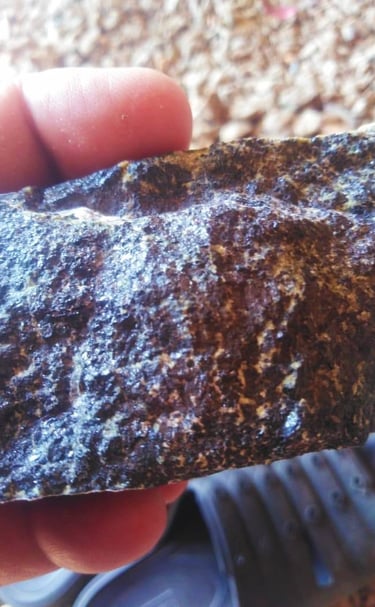
4. Petrographic Study
Description: A detailed examination of rocks, particularly thin sections of rock under a microscope, to determine their mineral composition and texture.
Key Activities:
Thin Section Preparation: Creating thin slices of rock for microscopic analysis.
Mineral Identification: Using petrographic techniques to identify minerals and their relationships.
Textural Analysis: Studying the size, shape, and arrangement of mineral grains within the rock.
Purpose: Provides insights into the formation conditions and history of the rock, aiding in resource assessment and geological interpretation.
5. Geochemical Analysis
Description: The study of the chemical composition of rocks, soils, and waters to understand mineralization and geological processes.
Key Activities:
Sampling: Collecting representative samples from various geological media.
Laboratory Analysis: Using techniques like X-ray fluorescence (XRF), inductively coupled plasma mass spectrometry (ICP-MS), and atomic absorption spectroscopy (AAS) to quantify elemental concentrations.
Geochemical Mapping: Creating maps that illustrate the distribution of various elements or compounds within an area.
Purpose: Essential for identifying mineral deposits, understanding geochemical processes, and assessing environmental impacts.
6. Geological Reports
Description: Comprehensive documents that summarize the findings from geological studies, including fieldwork, analyses, and interpretations.
Key Components:
Introduction and Objectives: Outlining the purpose of the study.
Methodology: Describing the techniques and approaches used in the study.
Findings: Presenting results from field studies, laboratory analyses, and modeling efforts.
Conclusions and Recommendations: Summarizing the implications of the findings for exploration, development, or environmental management.
Purpose: Provides stakeholders, including investors and regulatory bodies, with essential information for decision-making.
7. Environmental Assessment
Description: A systematic evaluation of the potential environmental impacts of proposed projects or activities, particularly in mining and construction.
Key Components:
Baseline Studies: Assessing existing environmental conditions before project initiation.
Impact Analysis: Evaluating how proposed activities could affect air, water, soil, and ecosystems.
Mitigation Strategies: Developing plans to minimize or mitigate negative environmental impacts.
Purpose: Ensures compliance with environmental regulations and helps in sustainable project planning, balancing development needs with environmental protection.
Advanced Technologies
Expert solutions for geological and geophysical exploration across industries.